
Course Info
A Little History…
Course Descriptions
The Midstate Trail came together in its present form around the late 1970s. For many years prior to this, several short trails had been in use in the general area where the Midstate Trail currently traverses. In the 1920s, a complete trail existed from Mt. Wachusett to Mt. Watatic however, this trail fell into disuse over the years. Around 1972, the Worcester County Commissioners proposed to create a trail across the entire county. They appointed a Citizen’s Advisory Committee for Trails. Later, after this committee splintered, a group of dedicated people formed the Midstate Trail Committee to plan the actual route and to work on its construction. Some of the Committee’s members belonged to the Worcester section of the Green Mountain Club, which encouraged the project.
Throughout the 1980s, the Green Mountain Club and many volunteers worked hard to bring the Midstate Trail to life. Their vision has resulted in a great feat of recreation that can take you, the runner, through some of the finest territory in Central Massachusetts. Few people, however, have dedicated themselves to the inception of the Trail as much as the late Lester Vielle, the late Bob Humes, Bob Eaton and Stan Whitman. Bob Elms and Rolf Larsen later continued this dedication. Their extraordinary commitment and drive was greatly responsible for making the Midstate Trail a reality.
Today, the Midstate Trail Committee, under the auspices of the Worcester chapter of the Appalachian Mountain Club, continues the administration and maintenance of the Trail. The Committee is augmented by a larger group of resident volunteer maintainers, who, like you, are invaluable to the survival of the Midstate Trail. Both AMC and GMC local chapters are assisting with recruitment of maintainers. The Committee welcomes anyone willing to help maintain a part of this “close to home” trail. The Department of Environmental Management has provided support, map printing, and publicity over the years.
100 Mile:
Trail / Dirt road: ~78 miles Paved Road: ~22 miles (majority after 60 miles)
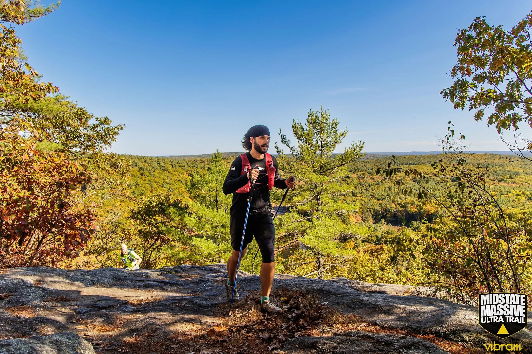
The 100 mile Midstate Massive Ultra Trail begins at the former site of Windblown Cross Country Ski Area. The first 30 miles of the 100 mile course contains technical, rocky trails, a large portion of elevation, and beautiful vistas.
From the bottom of Wachusett Mountain, begins a reroute off the Midstate Trail onto a multi-mile road section. The second 30 miles of the course runs through Princeton and the Savage Hill Wildlife Management area eventually bringing runners halfway to Crew Aid Station 7 and the 50 Mile start line at Long Pond Boat Ramp, Rutland, MA. This section of the course can be challenging to navigate during the night-time portion of the event.
In the last ~40 miles, road sections are more abundant, beginning with Aid Station 9 at Moose Hill Rd. Reservoir. Runners will have ~6.6 miles of road ahead to Aid Station 10 at Four Chimney’s. The next major road section is from Fay Mountain Farms Crew Aid Station 11 through Crew Aid Station 13 at Whittier farms where runners will encounter ~10.5 miles of road bisected halfway with ~1.5 miles of trail through Hodges Village Dam.
The final ~14 miles is mostly technical and rocky terrain with a small portion of fire road in Douglas State Forest where runners will round the Tri-State marker (MA,CT,RI) and find the finish line at the shore of Lake Wallum.
50 Mile:
Trail / Dirt road: ~ 35 miles Paved Road: ~15 miles
In the last ~40 miles, road sections are more abundant, beginning with Aid Station 9 at Moose Hill Rd. Reservoir. Runners will have ~6.6 miles of road ahead to Aid Station 10 at Four Chimneys. The next major road section is from Fay Mountain Farms Crew Aid Station 11 through Crew Aid Station 13 at Whittier farms where runners will encounter ~10.5 miles of road bisected halfway with ~1.5 miles of trail through Hodges Village Dam.
The final ~14 miles is mostly technical and rocky terrain with a small portion of fire road in Douglas State Forest where runners will round the Tri-State marker (MA,CT,RI) and find the finish line at the shore of Lake Wallum.
30 Mile:
Trail / Dirt road: ~18 miles Paved Road: ~12 miles
Beginning with 1.5 miles of trail and climbing, the 30 mile race leaves Howe State Park and joins the race at the intersection of North Charlton Rd. and Ash St. and contains the first road section of 1.5 miles to Aid Station 10 at Four Chimneys. The next major road section is from Fay Mountain Farms Crew Aid Station 11 through Crew Aid Station 13 at Whittier farms where runners will encounter ~10.5 miles of road bisected halfway with ~1.5 miles of trail through Hodges Village Dam.

Course Maps
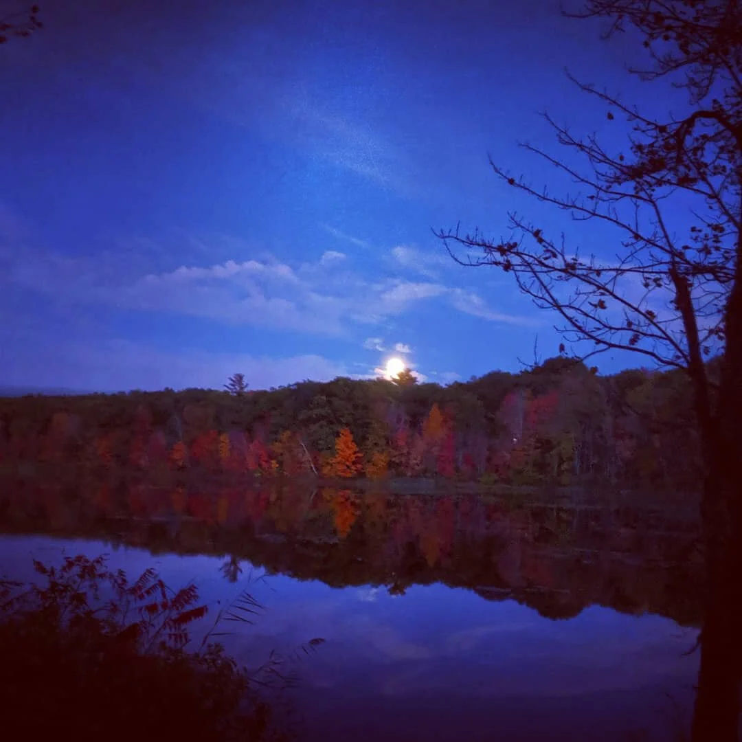
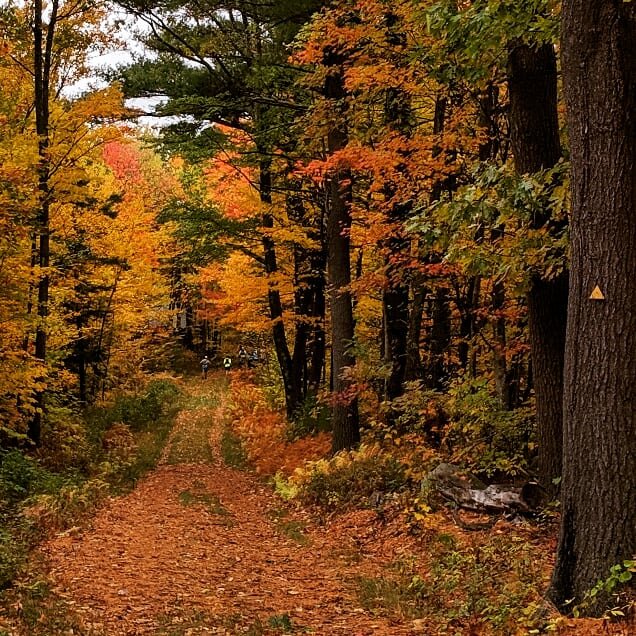
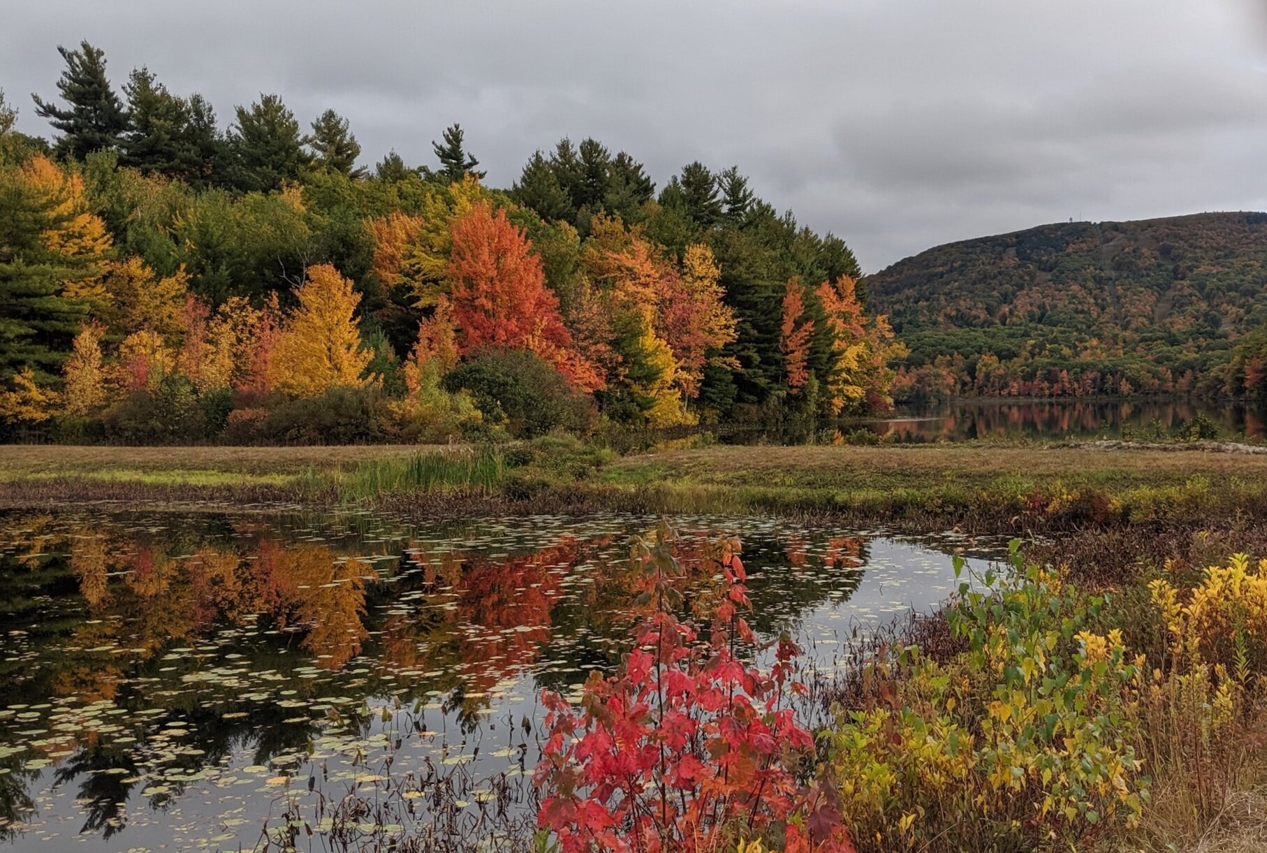
The 100M race starts at Windblown Cross Country Ski Area in New Ipswwich, NH and heads south towards Mt. Watatic. There will be no shortage of stunning views as you navigate the elevations of both Mt. Watatic and Wachusett at the height of New England foliage season.
Our course has been certified by the International Trail Running Association (ITRA). Furthermore, both the 100M and 50M events are now UTMB Index Races. Completing either Midstate Massive 100M or 50M events; runners will receive a UTMB Performance Index in the category of their completed race event. The Performance Index is used in a similar way as the ‘qualifying points’ to show a runner’s experience at different distances and can be used to enter the UTMB World Series Events and combined with Running Stones to enter the UTMB Finals.

The 50M race will start at DCR Rutland Lond Pond in Rutland, MA.
The 30M race will start at Howe State Park in Spencer, MA. This new location will add several miles of trail running while eliminating a second loop inside Douglas State Forest.
Leg Maps
The nature of running on the Midstate Trail is that it is a delicate balance of permissions between numerous landowners across the Commonwealth of MA. This means the actual trail route is somewhat dynamic year to year. The Midstate Trail Committee and their volunteers work very hard to keep the trail on a trail as best as possible but sometimes that isn’t always feasible. We have and will continue to work closely with them to ensure that we avoid sensitive landowners while developing strong relationships with other landowners who are advocates of the trail and its use.
Here are the course advisements for 2024:
TBD
We will post updates as we get closer to race weekend
2024 Maps and Pacing Tool
All files have been updated to reflect the 2024 course for all 3 events. Check out this combined map and pacing application to help you plan your race:
ultraPacer: 100M Leg Map
ultraPacer: 50M Leg Map
ultraPacer: 30M Leg Map
2024 GPX mapping is available below:
Full 30M GPX
Full 50M GPX
Full 100M GPX
Elevation Comparison
100 Mile: 13,615 ft gain
50 Mile: 5,395 ft gain
30 Mile: 3,332 ft gain
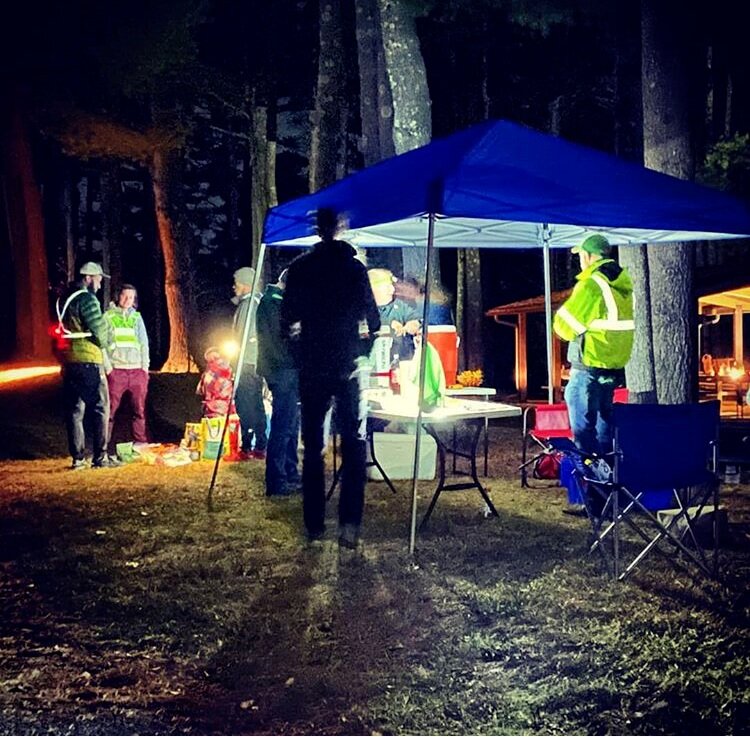


Aid Stations (AS) will be located at designated locations along the course route. Each AS will provide runner food, water, port-o-johns, and medical support. Some locations will feature a broader food selection depending on the community organization that is running it. A complete list of food items that will be served along the course will be provided at least 2 weeks before race day.
Click here for Aid Station Locations and timing.
Aid Stations
The Open and Close times for the Aid Stations are based on the projected arrival times of runners which are based on both your start time and projected pace. We’ve built in margins into these times in order to accommodate runners who may be running faster or slower than what they have projected (+/- 2 minutes/mile).
The Cut-Off time for the race will be Closing Time for each Aid Station. You must arrive before this time in order to continue.